


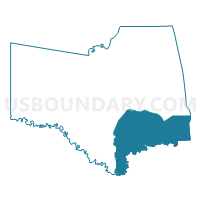
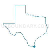
Voting District 0014, Cameron County, Texas
About
Outline

Summary
| Unique Area Identifier | 671297 |
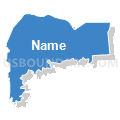
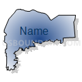
| Name | Voting District 0014 |
| County | Cameron County |
| State | Texas |
| Area (square miles) | 184.53 |
| Land Area (square miles) | 116.06 |
| Water Area (square miles) | 68.47 |
| % of Land Area | 62.90 |
| % of Water Area | 37.10 |
| Latitude of the Internal Point | 25.98192880 |
| Longtitude of the Internal Point | -97.28413380 |
Maps

Graphs
Select a template below for downloading or customizing gragh for Voting District 0014, Cameron County, Texas


Neighbors
Neighoring Voting District (by Name) Neighboring Voting District on the Map
- Voting District 0001, Cameron County, TX
- Voting District 0004, Cameron County, TX
- Voting District 0052, Cameron County, TX
- Voting District 0053, Cameron County, TX
- Voting District 0059, Cameron County, TX
- Voting District 0060, Cameron County, TX
- Voting District 0067, Cameron County, TX
- Voting District 0068, Cameron County, TX
- Voting District 0082, Cameron County, TX
- Voting District 0083, Cameron County, TX
Top 10 Neighboring County Subdivision (by Population) Neighboring County Subdivision on the Map
- Brownsville CCD, Cameron County, TX (206,752)
- Los Fresnos-Laureles CCD, Cameron County, TX (23,712)
- East Cameron CCD, Cameron County, TX (22,539)
Top 10 Neighboring Place (by Population) Neighboring Place on the Map
- Brownsville city, TX (175,023)
- Port Isabel city, TX (5,006)
- Laguna Heights CDP, TX (3,488)
- South Point CDP, TX (1,376)
- Reid Hope King CDP, TX (786)
Top 10 Neighboring Unified School District (by Population) Neighboring Unified School District on the Map
- Brownsville Independent School District, TX (189,748)
- Los Fresnos Consolidated Independent School District, TX (41,340)
- Point Isabel Independent School District, TX (15,783)
Top 10 Neighboring State Legislative District Lower Chamber (by Population) Neighboring State Legislative District Lower Chamber on the Map
- State House District 38, TX (182,363)
- State House District 43, TX (148,370)
- State House District 37, TX (142,621)
Top 10 Neighboring State Legislative District Upper Chamber (by Population) Neighboring State Legislative District Upper Chamber on the Map
Top 10 Neighboring 111th Congressional District (by Population) Neighboring 111th Congressional District on the Map
Top 10 Neighboring Census Tract (by Population) Neighboring Census Tract on the Map
- Census Tract 144, Cameron County, TX (12,877)
- Census Tract 141, Cameron County, TX (11,923)
- Census Tract 127, Cameron County, TX (5,621)
- Census Tract 142, Cameron County, TX (5,311)
- Census Tract 123.04, Cameron County, TX (4,696)
- Census Tract 123.01, Cameron County, TX (4,677)
- Census Tract 132.07, Cameron County, TX (4,050)
- Census Tract 123.05, Cameron County, TX (3,729)
- Census Tract 126.07, Cameron County, TX (2,973)
- Census Tract 9801, Cameron County, TX (10)